
Transforming the USS Mitscher: BAE’s Cutting-Edge Revamp
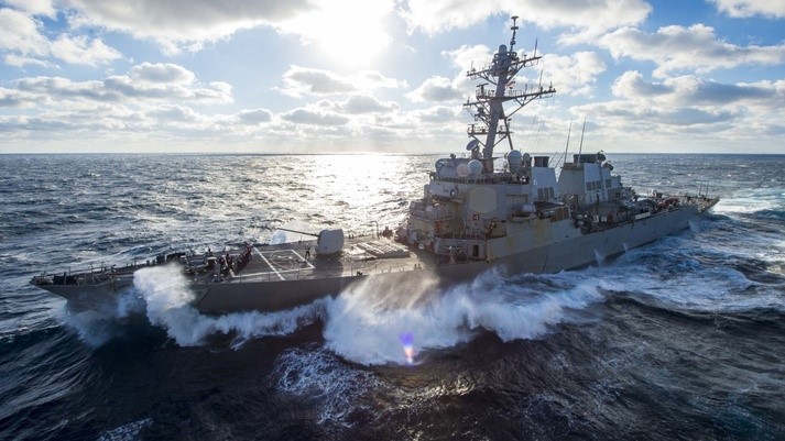
BAE Systems has secured a $1.9 million agreement from the U.S. Navy for the upkeep and enhancement of the Arleigh Burke-class guided-missile destroyer USS Mitscher (DDG 57).
The total worth of the competitively granted contract may escalate to $101.2 million if all options are exercised.
As per the docking selected restricted availability (DSRA) contract received, BAE Systems will dry-dock the vessel, carry out underwater hull preservation tasks, assist the Navy in upgrading the ship’s Aegis combat system and command and control technologies, and refurbish the living quarters for the ship’s 285 crew members. The task is anticipated to commence in March 2022 and conclude in April 2023.
“Our crew is eager for the preservation and enhancement work on USS Mitscher,” expressed Mike Bruneau, vice president and general manager of BAE Systems Norfolk Ship Repair. “Together with our subcontractor partners and Navy personnel, we will leverage our expertise with the DDG class to guarantee this vessel returns to the fleet mission-ready and fully equipped to support our national security.”
BAE Systems’ Norfolk shipyard is executing similar operations on the guided-missile destroyer USS Stout (DDG 55).
USS Mitscher is the second vessel of the U.S. Navy named in tribute to Admiral Marc Mitscher (1887-1947), who commanded the Fast Carrier Task Force 58 in the Pacific, acting as the Navy’s primary striking force during the latter stages of World War II. The current ship was commissioned in December 1994.
BAE Systems is a premier provider of ship repair, maintenance, modernization, conversion, and overhaul solutions for the Navy, various government entities, and selected commercial clients. The company runs three comprehensive shipyards in California, Florida, and Virginia, offering a highly qualified, seasoned workforce along with skilled program managers, seven dry-docks and railways, and ample pier space and ship support services. The Norfolk shipyard employs over 1,100 individuals and collaborates with the Navy and multiple subcontractor firms to achieve its ship sustainment objectives.